

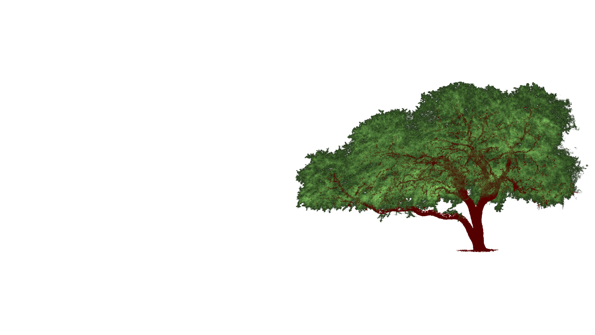
ArborTwins™
Rooted in reality.
At the intersection of arboriculture and digital twin technologies, we deliver precise, 3D visual data to help you understand, plan for and protect individual trees with confidence.
SERVICES
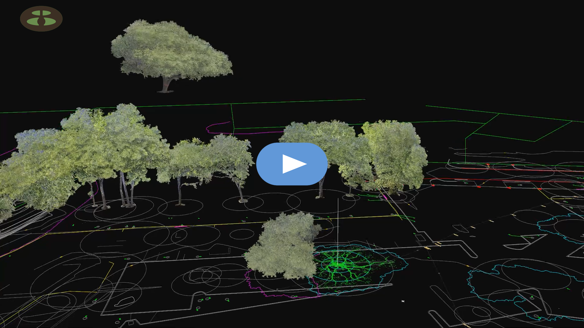
Tree Relocation Data
Plan the move first!
With LiDAR data, trees can now be relocated virtually, with precision and confidence for the long-term optimal health of the tree.
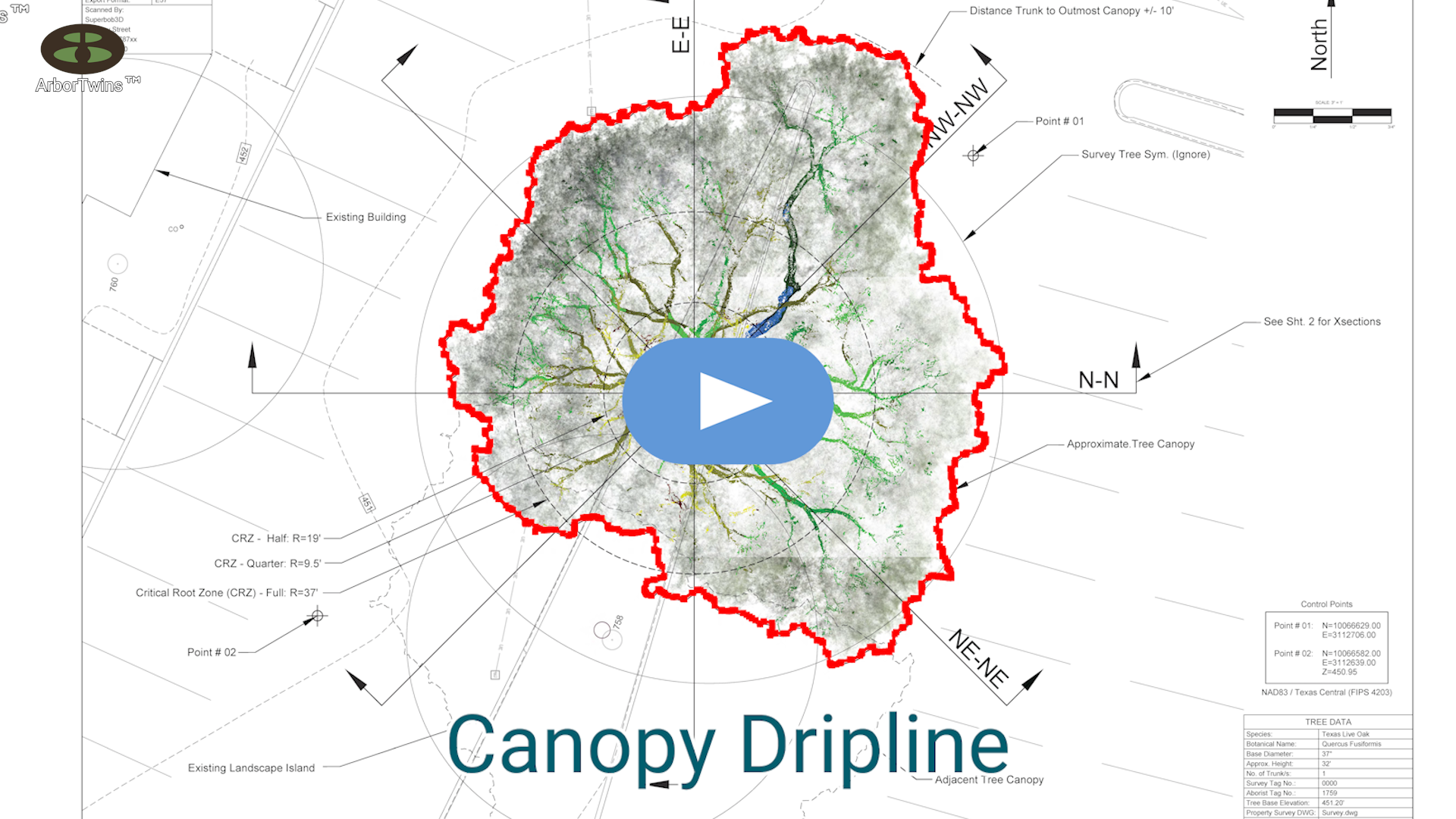
Comprehensive
Tree Exhibits
LiDAR-based exhibits provide unprecedented documentation of a tree’s complete description, geometry, and location; a digital reference that can be explored, shared and revisited over time.
Download Sample Exhibit PDF:
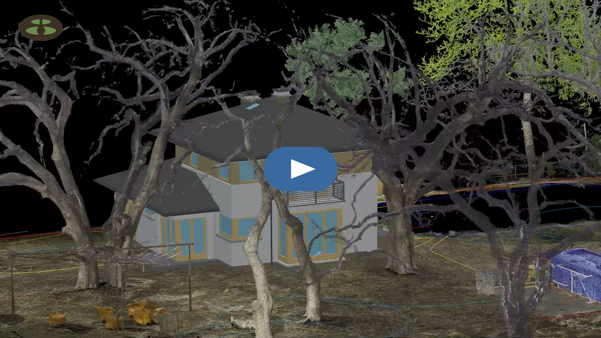
3D Modeling Reference
LiDAR scanners capture the exact geometry and physicality of a tree, creating a precise 3D reference for better informed decisions.
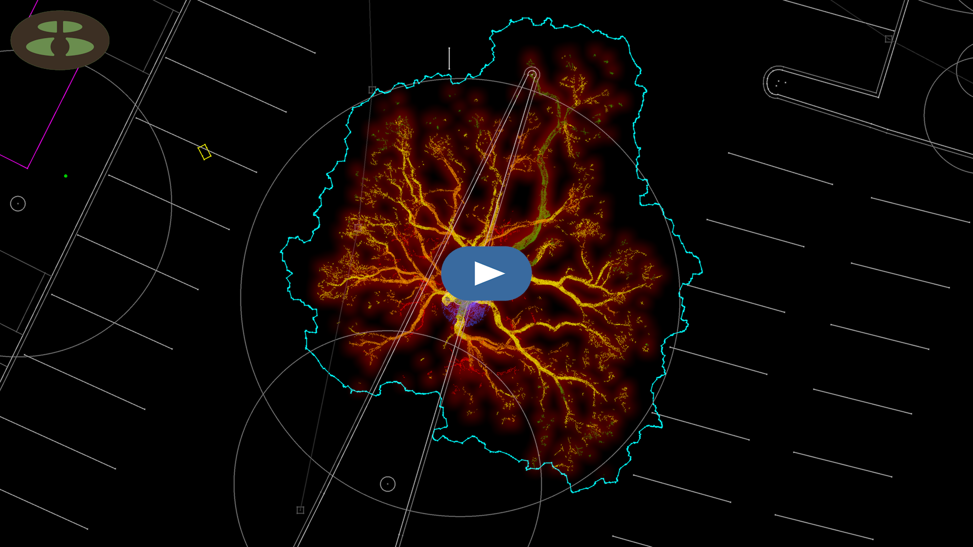
3D to 2D Asset Extraction
We can make your data ready for real-world execution with LiDAR data extraction from 3D to 2D.
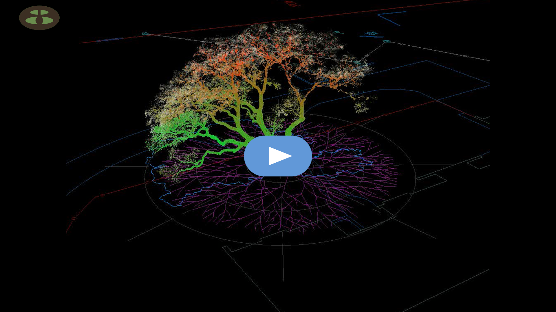
Integrated Ground Penetrating Radar (GPR) Root Data
3D GPR root data, captured in regions of the world where soils are compatible with this technology, can also be integrated into 3D tree exhibits.
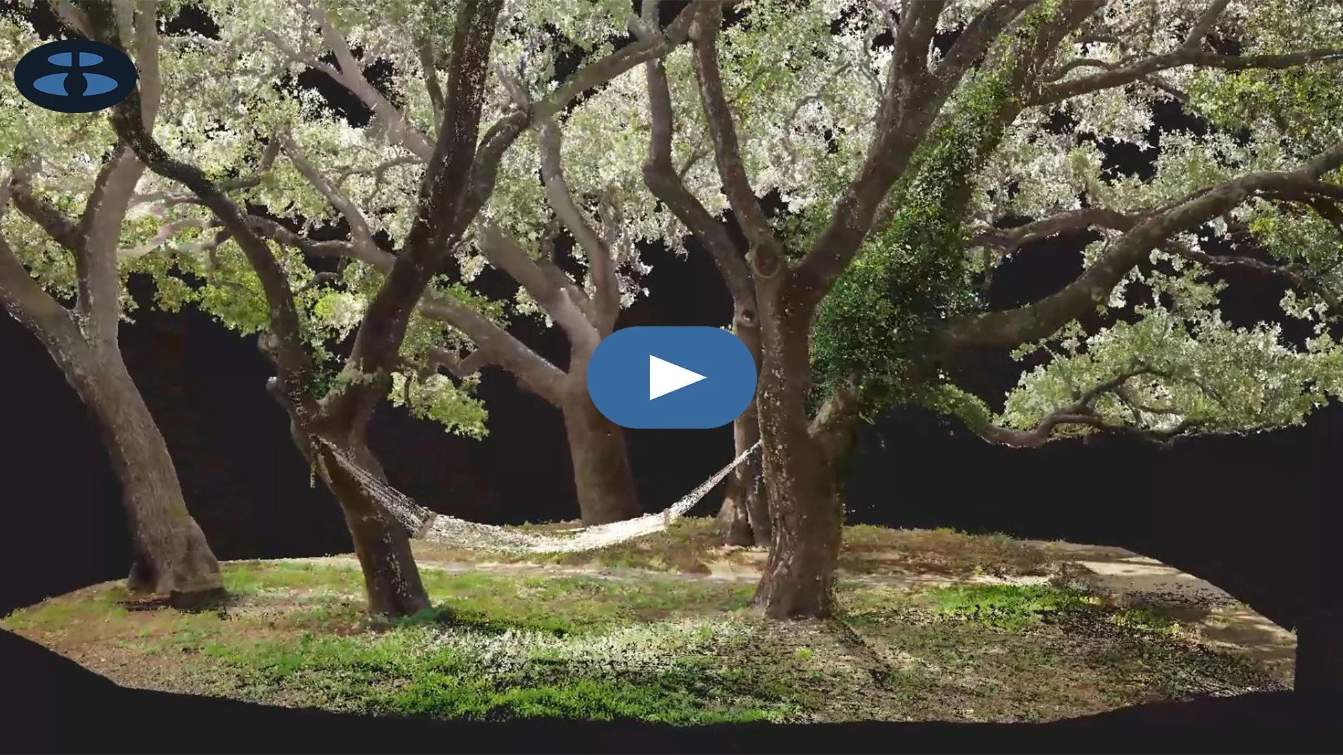
Tree Care Stewardship
A Digital Legacy for Every Tree.
Create a lasting digital twin that future generations can revisit to understand, monitor, and care for a tree over time.
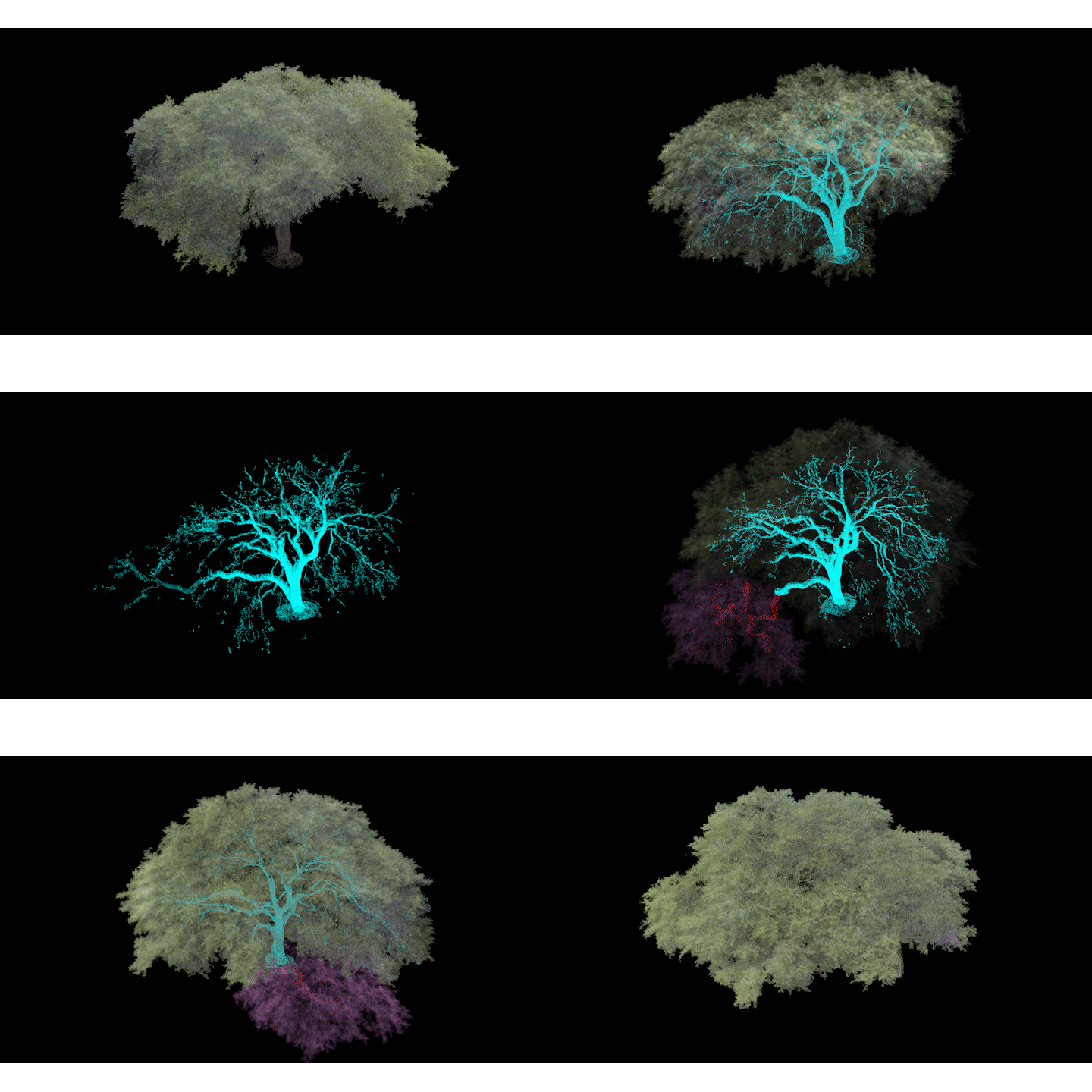
Virtual Pruning
Arborists can now recommend pruning in a precise 3D environment - so clients can see the proposed result, crews have a clear plan, and everyone can make informed decisions before work begins.
Click below to open a point cloud viewer:
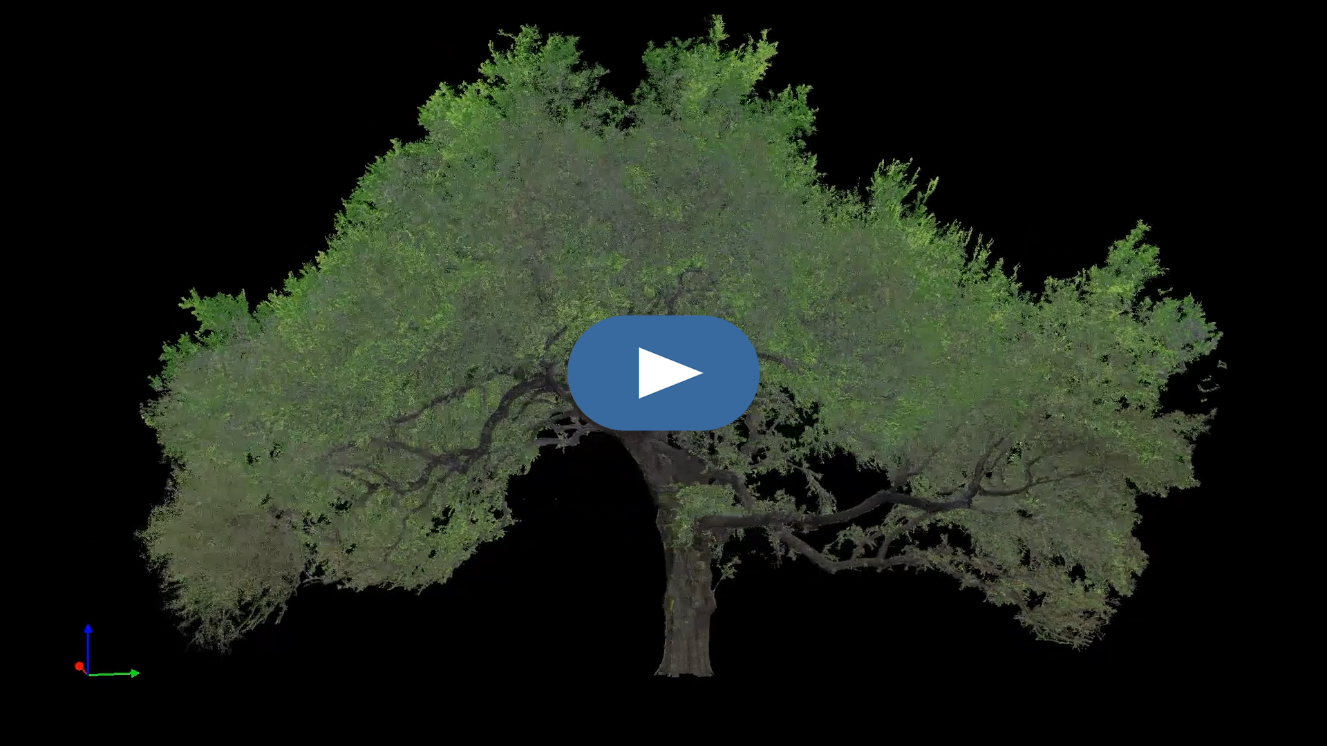
Canopy Color-Correction
Color correction adds realistic color and depth to LiDAR point clouds for compelling visuals that make complex tree data easier to understand and experience.
Why ArborTwins™?
-
Significant trees don't just complicate a site, they define it. ArborTwins™ delivers the precise individual tree data architects need to design around them confidently:
Separate classified point clouds for canopy and trunk/branch structure - the actual 3D geometry of each tree, not an estimated dripline circle
Precise canopy spread and root zone documentation for CRZ compliance and permit submissions
CAD-ready 2D plan and profile exhibits that are scaled, importable, and usable without specialized software
Point cloud data delivered in formats that integrate directly into your existing CAD and BIM environment
Remote project management. We coordinate local scanning wherever your project is, so you don't have to
What sets ArborTwins™ apart: every tree dataset is processed by hand, classification by classification, by someone who understands how architects actually use tree data in a design workflow, not just how it's collected in the field.
-
For landscape architects, trees aren't incidental to the design, they're often the reason the design exists. ArborTwins™ gives you the precise individual tree data you need to design with, around, and in defense of the significant trees that define your projects:
Separate classified point clouds for canopy and trunk/branch structure - the actual 3D geometry of each tree, not an estimated dripline circle drawn from a tape measure
Precise canopy spread, canopy volume, and root zone documentation, all the spatial data your planting plans, grading designs, and hardscape layouts depend on
Scaled 2D plan and profile exhibits in PDF and CAD-compatible formats, all importable directly into your existing design workflow without specialized software
CRZ and dripline documentation defensible enough to survive municipal review, HOA scrutiny, and contractor pushback
Individual tree data that distinguishes between trees, because no two oaks have the same canopy, and your design shouldn't treat them as if they do
Remote project management. We coordinate local scanning wherever your project is, so you stay focused on the design
What sets ArborTwins™ apart: landscape architects work at the intersection of living systems and built environments. That intersection demands data that reflects the actual complexity of individual trees, not approximations. Every ArborTwins™ dataset is processed by hand, tree by tree, by someone who understands how landscape architects use tree data in a design workflow and why getting it right from the start matters for everything that follows.
-
You know trees better than anyone. ArborTwins™ gives you the precise spatial data to document, communicate, and defend that knowledge, all in formats anyone can use:
Documentation & Appraisal
Separate classified point clouds for canopy and trunk/branch structure - a complete, measurable 3D record of each tree as it exists at the moment of capture
Precise canopy volume, spread, and DBH measurements for tree appraisal, canopy mapping, and condition documentation
Arborist-informed exhibits. Your health assessments, condition ratings, and preservation notes woven directly into the documentation
Tree Risk Assessment
Precise 3D structural documentation of trunk form, branch architecture, and codominant stems, all the spatial detail that informs failure potential and consequence assessments
A defensible baseline for monitoring structural change over time. Including canopy loss between assessments, measurable shifts after storm damage, documented evidence of construction encroachment
Plant Health Care & Wound Monitoring
Repeatable scan data that establishes a precise before, enabling measurable comparison of canopy volume, spread, and structure across assessment intervals
Documentation of wound location and surrounding structure for long-term monitoring and client reporting
Urban Forestry & Green Infrastructure
Canopy area and volume data for urban forestry planning, green infrastructure analysis, sidewalk shading assessments, and ordinance development
Scaled 2D plan exhibits suitable for HOA submissions, campus planning, and municipal review, all with no specialized software required on the recipient's end
Consulting Arboriculture
Defensible, precisely measured tree data for expert witness testimony, formal appraisals, and canopy mapping in proposed development contexts
Scaled 2D exhibits in PDF and CAD-compatible formats that are shareable with engineers, attorneys, architects, and municipal reviewers without requiring any specialized software on their end
Unique Situations
Point cloud data of tree structure for cabling and bracing assessments, rigging planning, tree house and swing attachment analysis, and training documentation
Precise canopy volume calculations for pruning material estimates, whichis useful for site logistics planning before major pruning operations
Utility line pruning documentation that captures existing canopy structure relative to line clearance requirements to inform minimum-impact pruning strategies
Research
Precise, repeatable 3D datasets suitable for pathology studies, biomechanics research, and management practice documentation - a spatial record that can be revisited, re-measured, and compared across time
Remote Project Management
We coordinate local scanning wherever your trees are, so you stay focused on the arboriculture
What sets ArborTwins™ apart: decurrent broadleaf species (like Live Oaks, Bur Oaks, and their kin) resist automated classification. Every ArborTwins™ dataset is processed by hand, tree by tree, by someone who understands what a well-classified tree point cloud should look like and why it matters for the work you do.
-
You don't have to be an arborist or an architect to care deeply about the trees on your property. Whether you're protecting a beloved oak from a planned renovation, documenting a significant tree for insurance or legal purposes, or simply wanting to understand what you have, ArborTwins™ delivers the precise individual tree data that gives you clarity and confidence:
A complete 3D record of each tree, including the canopy spread, trunk structure, and branch architecture, documented at a moment in time and yours to keep
Scaled 2D plan and profile exhibits in PDF format, readable and usable by anyone, from your contractor to your attorney to your municipal planning office
Precise canopy and root zone documentation for permit applications, HOA submissions, or municipal heritage tree reviews
A defensible record that establishes your tree's condition before construction begins and protecting you if disputes arise later
Arborist-informed exhibits available. If you're working with an ISA-certified arborist, their assessment data can be woven directly into your documentation
Remote project management. We coordinate everything locally, wherever your trees are
What sets ArborTwins apart: most tree owners never know precise documentation like this exists until they need it and it's too late.
-
Significant trees on a build site aren't just a design consideration, they're a legal one. ArborTwins™ gives custom home builders the precise individual tree documentation needed to protect the project, satisfy municipal requirements, and keep construction moving:
Separate classified point clouds for canopy and trunk/branch structure - the actual 3D geometry of each tree, not an estimated dripline circle that a municipal reviewer can challenge
Precise canopy spread and root zone documentation for CRZ compliance. All defensible measurements that hold up to heritage tree ordinance review
Scaled 2D plan and profile exhibits in PDF format, so they are ready for permit submission, inclusion in project documentation, or sharing with your architect and landscape architect without requiring any specialized software
Pre-construction baseline documentation gives a precise record of each tree's condition and geometry before ground is broken, protecting you if disputes arise later
Coordination of local scanning wherever your project is. We manage the scanning process so you stay focused on the build
-
Trees can't speak for themselves. But with precise data, they don't have to.
A tree that is fully understood is a tree that is harder to dismiss. Precise 3D documentation transforms a subjective plea to "save the tree" into an objective, measurable case for preservation.
A tree that is accurately documented before construction begins is a tree with a defensible root zone, the one that contractors, engineers, and municipalities can't ignore or underestimate.
A tree whose canopy and trunk structure are precisely classified is a tree whose dripline isn't guessed at, whose critical root zone isn't approximated, and whose protected area isn't quietly shrunk to accommodate a foundation.
A tree with a documented baseline has a before - a precise record of what it looked like, how large its canopy was, and what its structure contained before the excavators arrived. That before is what makes accountability possible after.
A tree in the hands of an informed arborist is a tree with an advocate who can measure, document, and demonstrate change over time, like canopy loss, structural decline, the measurable cost of construction encroachment.
A tree that has been seen, truly seen, in full three-dimensional detail, branch by branch and canopy layer by canopy layer, is a tree that is known. And what is known is worth protecting.
ArborTwins™ doesn't just serve the people responsible for trees. It serves the trees themselves.